VISION: "Indragiri Hulu Prosperous Year 2015"
Vision Assessing Regional Head and Deputy Head of
"Inhu PROSPEROUS YEAR 2015"
Field of Land, Sea and Air, Communications and Information Technology;
The creation of a safe traffic conditions, orderly and safe.
The creation of transportation of people and goods evenly, can reach out to all corners of the district.
Creation of adequate transport infrastructure (passenger and freight terminals, bus stops, traffic signs and other road infrastructure).
The creation of telecommunications networks, information evenly to all corners of the district.
Realization increase public knowledge through information quickly and accurately.
Creation apparatus capable, skilled and professional in his field.
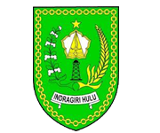
SYMBOL MEANING
Stipulated by local regulations Indragiri Hulu No. 11 of 1968 Provincial Institute Riau No. 1969.
Article 1.
Indragiri Hulu shaped emblem shield, symbol of struggle and protection that consists of five basic elements as follows:
Rubber tree, tall and well-built overall leaves a jasmine flower pentagon-shaped blade of Keris Umbrella written therein and a Screen Boats.
Cotton and rice are the two ends of which are nurcahaya berusudut five.
The Autonomous Region Level II Indragiri Hulu written on tape.
Gold chain encircling the shield-shaped.
Article 2.
Tata colors symbolize the following properties:
Green; Benediction hope and confidence.
Yellow Gold; Virtue wise and talented.
Black; stability, constancy and eternity.
White; Purity Clean selfless
Brown; earnestness.
GEOGRAPHICAL POSITION
The total area covers Indragiri Hulu 8.198.26 km ² (819,826.0 hectares) consisting of lower mainland, mainland high marsh with a height of 50-100m above sea level
Indragiri Hulu located at:
0 ° 15 ´North Latitude
1 ° 5 ´south latitude
101 ° 10 ´East Longitude
102 ° 48 ´East Longitude
Bordering Indragiri Hulu denan
North of the regency premises
The south by Bungo Tebo (Jambi Province)
West to the Kuantan District Singingi
East by Indragiri Hilir
The sub-district at the farthest distance from the capital city is the capital district Peranap rod with a distance of 96 km, while the closest distance to the capital city is the capital district Rengat yaiutu 0 miles.
Temperature and humidity somewhere between the other determined by the place with the low sea level and the distance of the maximum air pantai.suhu in 2009 is 33.4 ° C, while the minimum temperature in the range of 21.9 ° C. The maximum humidity is quite tini 98 ° C, humidity Sedankan minimum range at 51 ° C, with humidity av 83 ° C.
Somewhere rainfall is influenced by climatic conditions, the state of orthography and velocity / air flow of the meeting, therefore School Toilet rainfall varies by month and station observers. The highest rainfall in the year 2009 amounted to 463.3 mm, Sedankan lowest rainfall was 56.3 mm.
Indragiri Hulu Regency